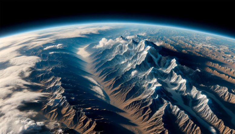
Recent research has revealed that Greater India, before its collision with Asia, was a single tectonic plate up to 3,000 kilometers wide, altering our understanding of Himalayan and Tibetan Plateau formation.
Compelling new evidence resolves discrepant interpretations and supports the large size of Greater India.
Hundreds of millions of years ago, the surface of the Earth looked very different from how we see it today. There were just two continents: Laurasia and Gondwanaland. The present Indian subcontinent was part of Gondwanaland, which broke up about 150 million years ago. A part of the Indian Plate that broke away from the Gondwana supercontinent is now subducted under the Himalayas and the Tibetan Plateau. Understanding the original extent of the ‘lost’ part of this continent, called Greater India, is therefore important to resolve several key questions surrounding the age of the India–Asia collision and answer how and when the Tibetan Plateau got built.
Research on Geological Convergence
However, estimates of the extent of Greater India have remained uncertain, varying from 100’s to more than 2,000 km. The Sangdanlin section lying between the Indian and Asian plates in southern Tibet represents a geologic Rosetta stone to constrain the initiation of the India–Asia collision; however, divergent evidence regarding its age and paleomagnetic record has made the estimation challenging.
Providing key answers, researchers from China University of Geosciences (Beijing) (CUGB) along with colleagues from other institutions, including Ludwig Maximilians University and the Chinese Academy of Sciences, have now clarified that Greater India was a single plate of 2,000 to 3,000 km before it subducted under Asia.
Scientific Perspectives and Findings
Professor Jun Meng from the School of Earth Sciences and Resources, CUGB, the first author of the study that was published in Proceedings of the National Academy of Sciences of the USA explains, “There are two primary models for the India–Asia collision. The first is a multistage collision model that subdivides the oceanic basin at the leading edge of India into smaller plates that were later incorporated into the Asian plate. The second model says that India and Greater India existed as a single plate in the Early Cretaceous period, with the upper crust of the northern margin of Greater India forming the Himalayan thrust belt and the lower crust being subducted under Asia.”
His colleague from CUGB, Professor Chengshan Wang adds, “Our goal was to understand which of these models was more accurate.”
The researchers resolved several questions surrounding these issues through a combined geologic, paleontologic, and paleomagnetic study of the infamous Sangdanlin section. The paleomagnetism of the Cretaceous rocks allowed the researchers to track the geographical position of the northern sector of the Indian Plate through time and calculate a minimum size for Greater India.
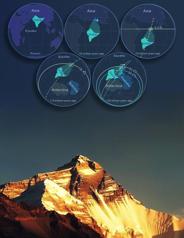
Reconstruction through time (top) showing the Indian Plate breaking away from the Gondwana supercontinent and subducting under Asia, thereby helping to create the world’s highest topography, i.e., Mount Everest (bottom). Credit: Jun Meng from China University of Geosciences (Beijing) and Prof. Stuart A. Gilder from Ludwig Maximilians University
Impact of Research on Tectonic Understanding
The data obtained in the study showed that the lithosphere— the rocky outer shell of the Earth—consumed by subduction since the onset of the collision 55 million years ago was larger than the area of the Indian subcontinent today and originally extended ~2,000 to 3,000 km to the north. Consequently, almost 5 million km² of lithosphere has been subducted under the Asian Plate, which must have contributed to the rise of the Tibetan Plateau.
These findings represent a tectonic shift in our understanding of the India–Asia collision and the emergence of various geological structures in these regions.
Prof. Stuart A. Gilder from Ludwig Maximilians University observes, “Our findings challenge established notions of the formation of Asia’s southern margin through the coalescence of independent tectonic blocks in the Tethys Ocean. They could help us fill the gap in the knowledge regarding the size of the Indian plate in a Gondwanaland configuration and the tectonic history of India up until its collision with Asia.”
Disruptive discoveries advance human knowledge in leaps and bounds. Kudos to the research team for contributing to such a discovery!
Reference: “Strengthening the argument for a large Greater India” by Jun Meng, Stuart A. Gilder, Xiaodong Tan, Xin Li, Yalin Li, Hui Luo, Noritoshi Suzuki, Zihao Wang, Yuchen Chi, Chunyang Zhang and Chengshan Wang, 8 August 2023, Proceedings of the National Academy of Sciences.
DOI: 10.1073/pnas.2305928120
About Professor Chengshan Wang
Chengshan Wang is a Professor at the School of Earth Sciences and Resources
at China University of Geosciences (Beijing). He is a member of the Chinese Academy of Sciences and the President of the Executive Committee of the Deep-time Digital Earth (DDE) Big Science Program. His research interests include the Cretaceous paleoenvironment and paleoclimate, tectonic uplift and sedimentary response, and analysis of petroliferous basins. With over 19,000 citations, he is a leader in the field of uplift of mountain ranges and has extensively studied the Tibetan Plateau and the Himalayan range. He has received The Li Siguang Geological Science Award and the National Award of Natural Sciences.
About Professor Jun Meng
Dr. Jun Meng is a professor at the School of Earth Sciences and Resources at the China University of Geosciences, Beijing, China. Prof. Meng’s research interests include paleomagnetism and tectonics. He has authored over 20 research papers in reputed scientific journals and has over 1,000 citations to his credit.
Note: This article have been indexed to our site. We do not claim legitimacy, ownership or copyright of any of the content above. To see the article at original source Click Here


