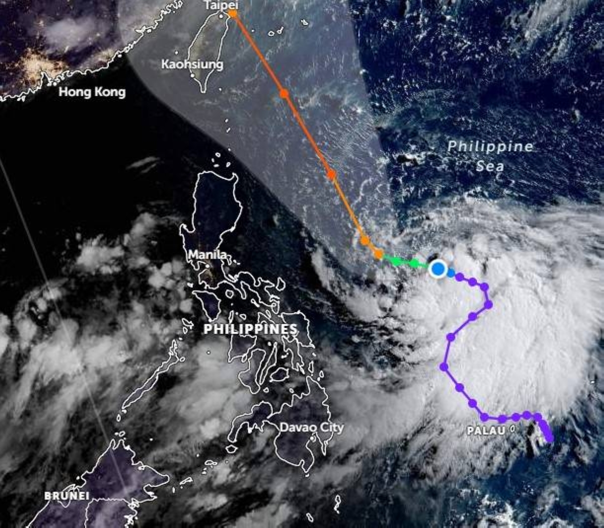
“EGAY” has intensified into a tropical storm as it moved westward over the Philippine sea, the state-run weather agency said in its 11:00 a.m. bulletin, on Saturday.
“Egay is forecast to intensify into a severe tropical storm in the next 24 hours. Through the forecast period, this tropical cyclone will continue to steadily intensify. It may reach peak at super typhoon category on Tuesday or Wednesday while over the Philippine Sea east of extreme Northern Luzon,” the Philippine Atmospheric Geophysical Astronomical Services Administration (Pagasa) said.
As of 10 a.m. the location of Egay’s center was estimated at 750 kilometers east of Virac, Catanduanes with maximum sustained winds of 65 kilometers per hour (kph) near the center and gustiness of up to 80 kph.
The current forecast track indicates that Egay will remain offshore over the Philippine Sea while the forecast confidence cone indicates that a landfall scenario over the northern portion of Northern Luzon is not ruled out.
Get the latest news
delivered to your inbox
Sign up for The Manila Times newsletters
By signing up with an email address, I acknowledge that I have read and agree to the Terms of Service and Privacy Policy.
No wind signals are raised at this time but in anticipation of the arrival of strong breeze to near-gale conditions associated with Egay, wind signals may be hoisted within the day or tomorrow in some areas in the Bicol Region and Eastern Visayas.
Pagasa said the enhanced southwest monsoon may also bring gusty conditions over the following areas exposed to winds: western and southern portions of Visayas, the northern portions of Northern Mindanao and Caraga, Romblon and Masbate.
Note: This article have been indexed to our site. We do not claim legitimacy, ownership or copyright of any of the content above. To see the article at original source Click Here


